Here are some pictures of the trip:

One of the towns we stopped at during our 6 hour journey to Mananjary. The landscape is quite different here than in Ambositra. Ambositra is in the central highlands and is a little colder. As we come down from the highlands, you can see the landscape turn much more tropical

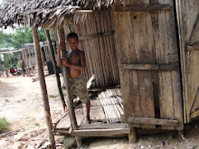
People in this town.

A view of the Indian Ocean from Mananjary.

Downtown Mananjary

More downtown Mananjary

 The road we took to get to one of the more remote villages. It took us an hour and a half to go 10 miles on this road.
Some children watching a game of pick-up soccer in on of the villages


Vohilava - One of the villages covered in our program.

Hangin' out on the jungle gym...

Dugout canoe

Laundromat

A road we were supposed to take to one of our villages. Obviously it is washed out and we couldn't cross.

Local cattle farmer we passed on our way to Vohilava

No comments:
Post a Comment